Days 7 & 8: Gressoney to Alagna to Macugnaga: Standard Exaggeration Factors and why we are bette
- Jul 25, 2017
- 5 min read

Gressoney to Alagna
Distance: 16km*
Ascent 1250m
Descent 1700m
Alagna to Macagnuga
Distance: 20km*
Ascent: 1650m
Descent: 1512m
*These are guidebook numbers before adaption for standard exaggeration factors. Read on for more accurate information.
When interpreting any information it is important to consider the Standard Exaggeration Factor (SEF) that has probably been included in that information. Clues can usually be gleaned from analysis of the character and motives of the author and in my experience factors for men usually range from 1 upwards. So I assumed that for male authors claiming to have done a 20km hike, you can generally apply a SEF of around 1.5 and discount the hike distance to 20/1.5 = 13.3km. Let's see how this applies in alpine hiking.
As you can see from the description of these two stages they are quite testing. From our balcony at Ellex Hotel in Gressoney in the shadow of Monte Rosa I began to ponder on our plans.

Had we bitten off more than we could chew? All of us were suffering from wobbly legs and these days seemed quite daunting.

It has become apparent that we are carrying a lot more stuff than we need and the weight of our bags is a massive burden on both up and downhill segments. Archie bravely volunteered a martyr-like solution and offered to carry Felix and my back-packs to the 2900m peak (on the cable car) so that we could enjoy the climb unencumbered. Hero!

Oh, what a difference! We flew up the hill pausing only briefly to imbibe from the generously proportioned water fountain on the way.

As we approached the peak where temperatures had plummeted to what felt close to freezing we spotted some kind of deer on a distant peak.
Stealthily we sneaked up on the magnificent beast which barely moved as we got closer and closer. If you ever come here to Col d'Olen you will see it too unless some scrap metal merchants get there first.
By the time we reached the top Archie had finished a few more stages in his Tiny Rails game and I had lost my lift pass. Fortunately, the generously spirited Italian lift folks waved us on anyway and we rode down to the beautiful village of Alagna at a lowly 1180m for a generous lunch.

The problem now was that for the next, most challenging stage so far, there are no lift options: it's a hike or a night on the mountain with no refuge.
I began to think about Napoleon and his defeat in 1812 leading an army of 650,000 men into Russia and (mostly) death. I also realised that SEFs were working against us in two ways. Firstly, I had neglected to consider my own (male) exaggerated sense of what we could achieve when planning the trip: SEF approximately 1.5 times. Second, I realised at last that hikers have a different method for application of SEFs. They understate the hike distance, the question now was, by how much?
Felix and I decided to put this to the test and hiked the "4km" to the beautiful Refugio Pastore 400m above Alagna using GPS and the Map-my-Run app. We followed the gushing river up the valley.

Past a splendid waterfall at Acqua Bianca.

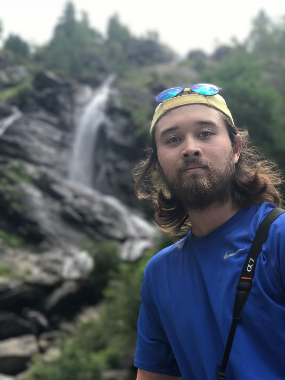
And to the mountain hut Rifugio Pastore, which is perched perfectly on the top of the waterfall with views up the valley to Monte Rosa.

Had I planned the trip better we would have stayed at Rifugio Pastore as it is beautiful and cuts a chunk off the next day's hike. That chunk, based on our GPS measurement is not 4km, it is 6.9km. So we now know the hiking guide book SEF is an inverse of 1.72x. So the "20km" hike with massive ups and downs is probably 34km.
So, to summarise: I overestimated our capacity by 1.5 times. The guidebook underestimated the distances by an estimated 1.72 times and the combination makes for the stage being more than double what we can do. To add a bit of icing to this cake of incompetence, poor planning meant that we stayed in Alagna rather than at the Rifugio..
We retreated to Alagna after our 13.8km recce and called a taxi to take us 125km by the road route to Macugnaga. We were deflated and EUR200 poorer, but unlike Napoleon's army, alive and ready to fight another day.
Today's Learning
Pack much less than you think you need. Generally carry less water too as it is available on most of the routes and yes, it does seem to be safe to drink from the mountain streams.
Today's second learning
There are quite a few mountain huts you can stay in along the route but which I could not find on the internet. You need the local maps to find these. From what we have seen, they are really good significantly reduce the routes and vertical compared to diverting into hotels in towns.
Summary for Lisa
We failed.
How it was for me
Felix (19):
Gressoney to Alagna was quite a pleasant walk, without the extra weight of the bag... I was thankful that we took the lift for the first leg of the journey, because to be honest I was still carrying over the fatigue from the day we rescued the Germans. Without the bags, we flew up the last leg of the mountain up to Col D'Olen. It took us about what the signs said it would, (which was surprising) but again that was without the added weight of bag or anything else slowing us down.
Alagna to Macugnaga was about as good as a EUR200 3 hour taxi ride could be. In the morning before the ride however, we decided that it would be a shame if we did no hiking at all. We decided to do a 'short' walk to Rifugio Pastore, which was advertised to us as a 45 minute hike. So, after 1.5 hours we made it. A total round trip of just under 14km, almost double what we thought it would be. At least my dad could take that awful picture of me.
How it was for me
Archie (14):
For the past 2 days I have been extremely lazy, I haven't done any walking. Form Gressoney to Alagna I took 4 lifts and the other two took 3. After my first coffee, the day before this walk, my energy was so, so low. I didn't want to walk, go out for lunch or do anything. This was also the same for the next day too.
The next day when we went from Alagna to Macugnaga we took a taxi. Again the other two did some extra hiking and they did that while I was having a leisurely time laying in bed watching youtube. They were supposed to be gone for about an hour but ended up going 6 km further than expected and they were out for about 2 and a half hours.
Yeah, so basically for the past two days I haven't done much and I've watched my fair share of youtube.


Comments